Breeding Bird Atlas

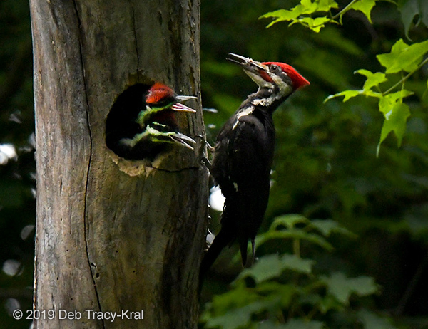
Pileated Woodpecker with young
ATLAS III BEGAN ON JANUARY 1, 2020! Atlasing is great fun and a “Don’t miss” experience for every birder. A Breeding Bird Atlas maps the distribution of each species of bird that breeds within the state. In New York State the first Atlas was completed in 1985 after five years of field work. New York was the first state to repeat their Atlas, done in 2000-2005. Now we can see changes in the breeding locations used by each bird. Members of the Ralph T. Waterman Bird Club provided valuable field work for both Atlases, surveying over 90 blocks within Dutchess County.
The 2020-2024 Atlas will have new features, with a different blocks designed to make better comparisons from atlas to atlas possible, and with all data being entered into eBird, the real-time, world-wide online checklist program for counting birds developed by the Cornell Lab of Ornithology. See eBird.org/atlasny for more information.
For a single page summary of how to get involved, click here.
If you would like to participate with the Waterman Bird Club, send an email to website1@watermanbirdclub.org, with the subject line: atlas participation.
Also read the following articles to learn more about what it is like to do “atlasing” and to learn about the “breeding codes” used to document the breeding status of birds.
ATLAS HISTORY
For general information, see https://ebird.org/atlasny/about/results.
See the 2000-2005 Breeding Bird Atlas home page for more information about the methods used. BBA home page
See the results of both Atlases, with maps showing the changes between the two Atlases. Atlas results and maps
Ravens have expanded dramatically since the first Atlas, including a move into Dutchess County. To see the Raven maps click on the results link above, scroll down and click on “Alphabetic Order”. Click on “Raven”, then on “Common Raven”.
OR, click here to go directly to the Raven maps.


